
Work Environment
This occupation is typically found in the following Career Sector(s):


Videos on the Web
- Cartographer- from: Youtube Search
- Cartographer- from: icould [UK] Video
Most commonly reported Work Activities
- Getting Information Observing, receiving, and otherwise obtaining information from all relevant sources.
- Interacting With Computers Using computers and computer systems (including hardware and software) to program, write software, set up functions, enter data, or process information.
- Making Decisions and Solving Problems Analysing information and evaluating results to choose the best solution and solve problems.
- Evaluating Information to Determine Compliance with Standards Using relevant information and individual judgment to determine whether events or processes comply with laws, regulations, or standards.
- Updating and Using Relevant Knowledge Keeping up-to-date technically and applying new knowledge to your job.
- Identifying Objects, Actions, and Events Identifying information by categorising, estimating, recognising differences or similarities, and detecting changes in circumstances or events.
- Documenting/Recording Information Entering, recording, storing, or maintaining information in written or electronic/magnetic form.
- Processing Information Compiling, coding, categorising, calculating, tabulating, auditing, or verifying information or data.
- Communicating with Persons Outside Organisation Communicating with people outside the organisation, representing the organisation to customers, the public, government, and other external sources. This information can be exchanged in person, in writing, or by telephone or e-mail.
- Analysing Data or Information Identifying the underlying principles, reasons, or facts of information by breaking down information or data into separate parts.
Working Life
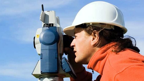
Cartographers design and prepare maps, plans, charts, models and globes that represent the surface of the Earth or other planets. They collect and use data from a range of sources such as:
- Aerial photographs
- Images produced by electrostatic mapping and seismic sensing
- Existing maps and statistics
Generally map making comprises the following skills:
- Photogrammetry - The interpretation of aerial photographs
- Field Survey - Investigation on the Ground or by Flight Crews
- Graphics - Creation of maps
- Spatial Data Management - Maintenance of Mapping Database and production of Large Scale Products
- Geodesy - the science of where we are in the world
- Cartography Design - Production of Maps mainly for the Tourist and Leisure Market or Special Requests
- Geographic Information Systems - GPS and Geographic products like OSI/An Post's Address Database
Cartographers analyse and interpret information from a range of sources and prepare reports. The cartographer evaluates this data and specifies lines, tones and symbols for a cartographic draughtsperson to use to produce maps and charts.
As well as preparing new maps, cartographers change existing maps. Cartographers deal with a range of mapping projects. They may prepare maps showing population distribution, the layout of ancient cities or even the Moon's surface and they may specialise in areas such as topographical maps. The type of map depends on the employer's or customer's requirements. The mapping database at Ordnance Survey Ireland is entirely electronic and Field Revisers use digital tablets to record changes in the topographic structure.
Most commonly reported Work Tasks
- Compile data required for map preparation, including aerial photographs, survey notes, records, reports, and original maps.
- Delineate aerial photographic detail, such as control points, hydrography, topography, and cultural features, using precision stereoplotting apparatus or drafting instruments.
- Prepare and alter trace maps, charts, tables, detailed drawings, and three-dimensional optical models of terrain using stereoscopic plotting and computer graphics equipment.
- Study legal records to establish boundaries of local, national, and international properties.
- Inspect final compositions to ensure completeness and accuracy.
- Revise existing maps and charts, making all necessary corrections and adjustments.
- Identify, scale, and orient geodetic points, elevations, and other planimetric or topographic features, applying standard mathematical formulas.
- Collect information about specific features of the Earth, using aerial photography and other digital remote sensing techniques.
- Examine and analyse data from ground surveys, reports, aerial photographs, and satellite images to prepare topographic maps, aerial-photograph mosaics, and related charts.
- Build and update digital databases.
Further Information
- Cartographer- from: N.C.S. [UK]
- Cartographer- from: GradIreland
Qualities - Cartographer
As a cartographer you need to have patience, as it may take many months to complete a single sheet map. You need a sense of design, an interest in geography and ability in mathematics. They need the knowledge and interest in symbols with the ability to visualise the world in an abstract and scaled down form. A flare for Maths and Science is favourable to this job, with attention to detail and neat work also desirable.
Travel is quite popular within this profession to get information.
Interests - Cartographer
This occupation is typically suited for people with the following Career Interests:
Realist
Realists are usually interested in 'things' - such as buildings, mechanics, equipment, tools, electronics etc. Their primary focus is dealing with these - as in building, fixing, operating or designing them. Involvement in these areas leads to high manual skills, or a fine aptitude for practical design - as found in the various forms of engineering.
Realists like to find practical solutions to problems using tools, technology and skilled work. Realists usually prefer to be active in their work environment, often do most of their work alone, and enjoy taking decisive action with a minimum amount of discussion and paperwork.
Investigative
The Investigative person will usually find a particular area of science to be of interest. They are inclined toward intellectual and analytical activities and enjoy observation and theory. They may prefer thought to action, and enjoy the challenge of solving problems with sophiscticated technology. These types prefer mentally stimulating environments and often pay close attention to developments in their chosen field.
Administrative
Administrative people are interested in work that offers security and a sense of being part of a larger process. They may be at their most productive under supervisors who give clear guidelines and while performing routine tasks in a methodical and reliable way.
They tend to enjoy clerical and most forms of office work, where they perform essential administrative duties. They often form the backbone of large and small organisations alike. They may enjoy being in charge of office filing systems, and using computers and other office equipment to keep things running smoothly. They usually like routine work hours and prefer comfortable indoor workplaces.
Entry / Progression - Cartographer
There are many pathways to develop towards this career. A degree in Geography, Geomatics, Earth Sciences, Geographic Information Systems (GIS), Marine Science. Courses in surveying and measurement or drafting are also useful.
Sample Education and Training Pathways
A number of courses are available throughout the country that focus on learning and skills that may be useful for this career. The examples and links below may guide you in your research.
Further Education (FET)
Further Education & Training (FET) Courses are delivered by local ETBs, ranging in duration from several weeks up to 20 months. Courses are designed to meet the labour market needs and often include a large element of work experience.
Example search terms include: architectural technology, computer-aided design, supervisory management leadership, CNC, computer numeric control operator, software developer.
Search for FET Courses
PLC Courses (FET)
PLC courses are full-time courses, one or two years duration, with awards at Level 5 and 6 on the NFQ. They are offered nationally in Schools and Colleges of Further Education.
Example search terms include: autocad, 2D introduction, graphic design, illustration, graphic design.
Search for PLC Courses
Apprenticeships:
Apprenticeships are structured work-based training programs that combine on-the-job training with classroom instruction. They run from 2 – 4 years and are open to individuals of all ages, including school leavers, those seeking a career change, and existing employees who wish to upskill.
Examples: ICT Software Development, Software Solutions Architect.
Search for Apprenticeships
Higher Education CAO (Undergraduate)
Higher Education courses at Levels 6 to 8 on the NFQ, delivered in Universities and Technological Universities & Institutes. Courses run from 2 – 5 years and places are allocated on a points-based system, processed by the Central Application Office.
Example search terms include: geography, geomatics, earth sciences, geographic information systems, GIS, marine science, surveying and measurement, graphic and digital design, geographic science, draughting.
Search for CAO Courses
Higher Education (Postgraduate)
Postgraduate courses are courses at Levels 9 and 10 on the NFQ and usually last 1 – 2 years full time, or longer if a PhD or part time. Entrants typically require an undergraduate award (Level 8).
Example search terms include: geographic information science, geographical information systems, spatial demography, geocomputation, research, environmental management, geographic information systems, digital land surveying, GPS, practical land surveying, geospatial data analysis, revit, 4D BIM.
Search for Postgraduate Courses
Professional Development
Professional development (CPD) courses are specialised training, formal education, or advanced professional learning that improves skills, professional knowledge, competency, and overall effectiveness in the professional world.
Check the Useful Contacts tab on this page to see if there are any professional bodies listed who may provide training related to this career.
Pay & Salary - Cartographer
Salary Range (thousands per year)* €29k - €79k
Salaries vary based on employer, location, experience, duties, and role.
Data Source(s):
Salaryexpert/ Eirieri/ Payscale
Last Updated: July, 2024
Labour Market Updates - Cartographer
Note: The following information relates to occupations that include: Architects; Town planners; Quantity surveyors; Chartered surveyors; Chartered architectural technologists.
This information has been derived from the Solas National Skills Bulletin (2023).
The annual average employment growth was above average for this occupation, although employment levels declined marginally between 2021 and 2022. New employment permits issued in 2022 related to quantity surveyors and issues with recruitment of quantity surveyors were also evident in both the Skills for Growth and Recruitment Agency Survey data.
The supply of quantity surveyors has increased since 2016, with 336 awards in 2021 in higher education. The demand for these skills is expected to be sustained in the coming years, although the tasks may be incorporated into other occupations e.g. structural engineer. With supply increasing, issues with recruitment may lessen in future years. Demand for architects and town planners is likely to continue, although the data does not currently point to issues in relation to sourcing suitably qualified personnel for these roles.
Useful Contacts - Cartographer
-
Public Appointments Service
- Chapter House, 26/30 Abbey Street Upper, Dublin 1, D01 C7W6
- (01) 858 7400 or Local: 1890 44 9999
- [email protected]
- Click Here
-
Ordnance Survey Ireland